Nobody Does the Wapiskau!
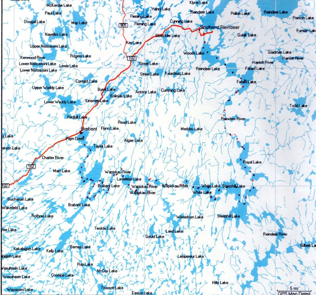

The “toughest man in the Rockies”, Joe Gutkoski, told us that the Wapiskau trail of the Churchill River would take just 5 days. We took off northeast to Val Marie with the 80 lb. 17’ Old Town Royalex Ranger canoe and lots of food and gear. After staying at the convent inn, we drove through Swift Current, Saskatoon and Prince Albert (PA), before turning north to La Ronge. We bought some last minute treats, blueberry jam and honey, and went on to Brabant Lake Trading Post. We had been advised to register with the RCMP at Reindeer Lake. If we did not reappear in two weeks, they would look for us, or so we thought. After a big dinner, a good night’s sleep and a big breakfast in the friendly compound, we prepared our gear at the beach. We were both proud and afraid. We hoped that our gear, and our dog Byrd, would protect us.
After we pushed off, we began to feel a sense of freedom that comes with the quiet, the light breeze, and the clear water. We had a primitive GPS device and the large maps from the Canadian government. Translating those maps with what we saw ahead was not easy. We quit early, at a small island where an eagle had just landed in a treetop. We tried to choose islands for camping, hoping it less likely to encounter bears. Already tired, we slept well. But, when we woke, we both were acutely aware that we were the only ones responsible for navigating through the lakes and rivers of grass, to emerge safely at Reindeer Lake. No one would look, and no one would find us, not with a green canoe and one small red spade.
19 portages. No, there were at least 21. A few portages were short, but some were a km or more. Regardless, each required unpacking the canoe, carrying the canoe, our gear and our food to the exit point, then reloading and tying down. Byrd was really no help in this. At the first few stops we left a gift for the next voyageur – the jam, the honey, … The canoe still weighed 80 lb. We grew stronger and thinner each day of the trip. At each of the falls before the portages, Ruth would speed up her paddling so that we would almost run up on the beach. We realized that our choice of food and gear storage bins might limit us. The large bins were not water tight. Should we capsize, much would be gone. We were careful with our paddles, but the gear was not really safe.
On the third night, we stayed at a lovely bend in the river. Suddenly, slap, slap, slap! A beaver did not like us near its home. After first tying Byrd up, we finally released her, so a few barks silenced it. We kept the wooden paddles close to the tent, so as not to become snacks for a beaver family.
Turning a corner, there was a long, high portage. Doug expertly lined the canoe through the water, while Ruth carried a small amount of gear. There was a beautiful island in the middle of the river, just before the falls, a perfect campsite (photo). We jumped into the canoe and paddled the fast water to a landing. It was such a beautiful evening that we decided not to pitch the tent and rest in our conjoined sleeping bag. After dinner, we slipped into the bags. Then, a cloud of tiny mosquitoes appeared. We found our mosquito gear to cover our heads and shoulders. Byrd was suffering so much that we lifted the top of the bags, and she raced inside, down to our feet, where she stayed all night. Other than that, the sound of the falls gave us peaceful sleep.
Navigating across the Wapiskau River and lakes, we learned to find the exits, often rivers of grass, not just by map, but by watching the trees in the background apparently moving in opposite directions. Whether to keep to the shore or cross the wide waters was Doug’s decision. If the wind was at our backs, I would sometimes use the paddle for a sail while Doug steered. I should mention that Byrd rested peacefully in the belly of the canoe, never rocking the boat. At Steephill Lake there was a 2 km long portage to bypass the falls. We just could not bring ourselves to do that, and would need to find a way to go UP the falls. So, we headed toward a small rock island just before the falls. I was instructed to jump to shore, not easy for me. I emerged from the canoe, and held onto the rope at the bow so that Doug could walk the canoe around the rock. His foot stuck in a crevice! He removed his foot and managed to retrieve his water sandal. However, he was in the middle of the water which rushed by on both sides of the rock from the falls above us. I held on to the rope and managed to help bring Doug to shore. The rope was new and sturdy, and saved our lives. After resting, we tried to see how to bypass the wide falls. A leaf floated by. We watched its path, and found that we should be able to follow the same path over/around the falls. We beached on the sand at the left, and relaxed and swam.
This left turn took us into Royal Lake, and then, upstream on the Reindeer River. The paddling north was hot and tiresome, and the campsite swampy. Doug made a lovely soup, but I just fell over in the tent and fell asleep. We paddled into Fafard Lake, with clear waters and fresh air again. Right in the middle was a beautiful island just at the point where the Reindeer River turned west. We would have liked to stay there a long time. There was a brisk wind in the morning, so Doug put up the canoe sail, and we readied for departure. The wind died. Doug zipped off his pants legs to wade into the water while removing the sail. We set to paddling slowly while Doug put his pants legs back on. There was only one! We looked back, and there was the other floating on the water. Having a full pair of pants, we were on our way to our last portage at the dam. We stopped short of that on a beautiful island. Doug stopped fishing because it was too easy. We bathed and relaxed. Byrd, too.
The next morning we went on the ramp before the dam. We saw two dogs, and then, the first person we had seen in 12 days. He asked us where we had come from. Astonished, he said “nobody does the Wapiskau!” After chatting for a while we relaunched. Byrd began to whimper. All of the time on land playing with other dogs, and she had forgotten to pee. We found a tiny rock for her.
As we paddled toward Reindeer Lake, it seemed as if Doug stopped paddling. Perhaps he didn’t want to end the trip. We guessed at which branch of the lake to enter, and finally paddled into Southend. The RCMP was not expecting us.
After returning to the Brabant Trading Post by car, we went in the diner to eat. The owners didn’t recognize us at first, but then gave us free dinner and lots of ice cream. We had made it.
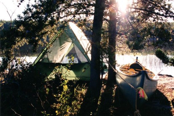
Beaver Island 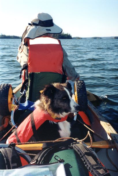
Byrd on the job 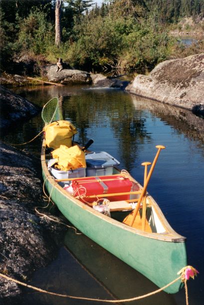
canoe load 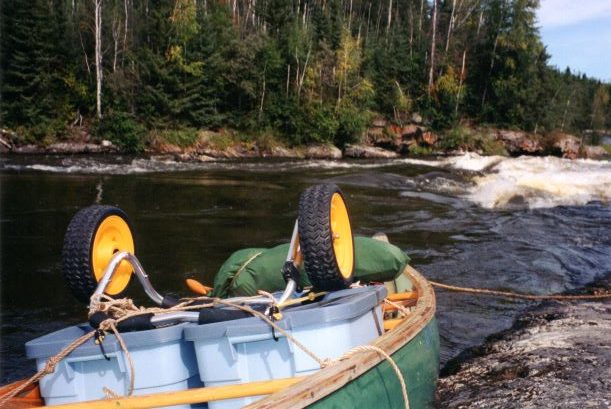
before going up falls 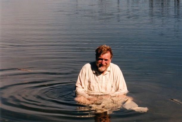
Doug laundry 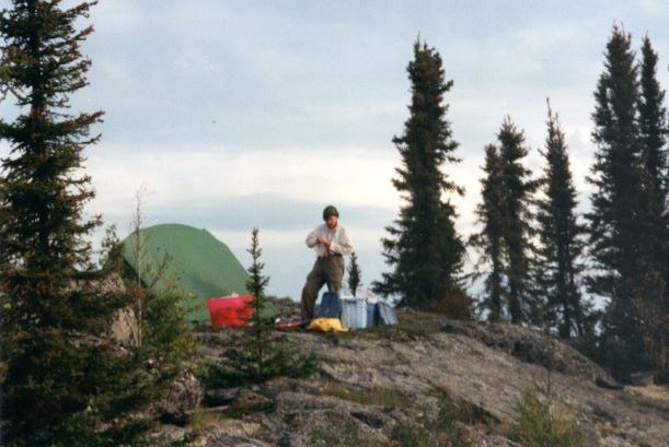
camp at Reindeer River turn 
camp before dam
Which way is Stanley Mission?
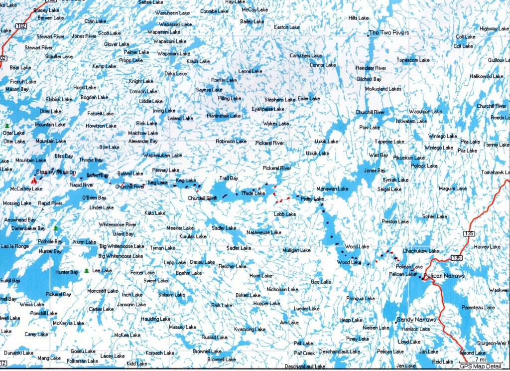
We brought blue barrels for this trip, water tight and buoyant. The other significant change was renting a satellite phone, because Doug’s mother worried about us. A red blanket, just in case we needed help. It would be another 12 day trip.
We drove up to LaRonge, and met Dan, who would take us to the dock before Stanley Mission, and pick us up at Pelican Narrows when we called. The weather forecast was stormy, so we debated not starting the trip. Dan encouraged us to go. With our gear packed in the canoe, we were about to step in, when Doug asked “which way is Stanley Mission?” He hadn’t looked at our maps yet!
We paddled past the mission toward a strait with an island to the right. We camped there for the night to have an early start in the morning. The day was sparkling and beautiful. At this point of the river system, there was no need for GPS or maps; empty milk bottles marked the channel. This day was so lovely, I thought that we would paddle longer, but about 3:30, Doug said that we must find a campsite – a storm was coming. It made no sense! Nonetheless, there was an island ahead that had been set up as a fishing camp, high above the water. We hauled up our gear and canoe, and tied the canoe bow and stern. We immediately began to set up the tent. A wind started to come up. Rain and hail. We went inside to try to hold the tent together with our hands and feet. Byrd cowered at the back of the tent. Trees began crashing around us. I could see out of tent flap as the tree to which the canoe was tied cracked in two, fortunately above the rope. As quickly as it started, the winds subsided. We still had a canoe. The tent was intact. Doug made dinner and we fell asleep. Only after the trip was over did we learn that we had survived a tornado.
The next morning, we decided to call Erma. Doug was talking with her, sitting on a log in the sunshine, when an eagle snagged a fish from the river and flew a foot over his head. Was this a sign of good days ahead?
There were not as many portages on this trip. We paddled onward through a few smaller lakes. As we exited Keg Lake, we took winding turns in the river past a waterfall, and burst into Trade Lake. Trade Lake is enormous from the vantage point of a 17’ canoe. Doug steered us expertly along shore lines and across wide waters. The winds came up as we passed the narrow part of the lake. I was on my knees paddling as Doug steered us across the high waves. We barely made a small island in the middle of the lake, around its first point. We camped here for two nights, waiting for the wind to die down, passing time reading an old Jimmy Buffett book aloud. Finally leaving this tiny place, we paddled across what seemed like an endless expanse of water. Doug stood on the gunwales to look for an island to camp for the night. Remember that Byrd does not rock the boat. There was a tall, pine-dense island ahead. We clambered up the cliff, bringing our gear. I was afraid for Doug to go down with the water bucket too many times for water. This was not good. We needed water. After dinner and a sound sleep, we awoke early to the sound of loons, hundreds of loons. We did not know that they lived in this part of the world. Yet, they must enjoy life here more than in New Hampshire. They sang and soared and played.
The next morning we had to make our way to the other side of the lake to find a narrow passage to the southeast. We worked our way through this to Pixley Lake. Part of this was a small sluice, which we decided to run. At the end of this was a rail portage to Wood Lake. There were wide falls in the middle of Wood Lake. This is the place to note that in this trip, we saw more people, mainly First Peoples living on the island and the shores. Many of them had Lund boats which they used to skim the portages and falls. At one point, there was an abandoned Lund boat that had not made it.
As we made our way through the rivers of grass, the landscape opened to reveal what we had heard – wildfires the fall before had left the islands and part of the landscape full of snags and ash. Finally, we found the exit toward Pelican Narrows. Of course, the winds came up, and I was back on my knees till we finally landed near the town site. It took a while to contact Dan, who had been up all night. He had made an arrowhead necklace for us to mark the completion of our trip. Our friend Kale in Finland now wears this.
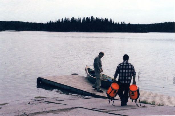
Doug & Dan loading 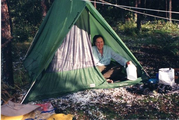
Ruth bailing hail 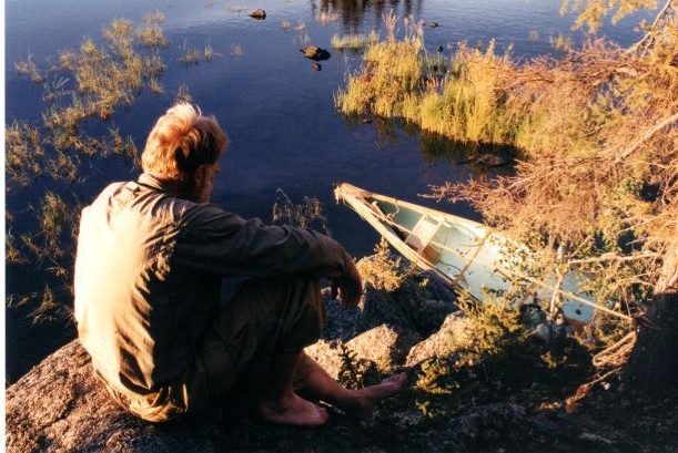
contemplating canoe below 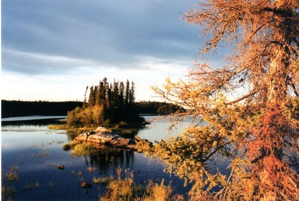
Trade Lake 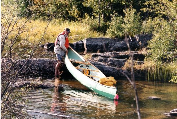
portage 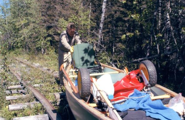
rail portage